Near Real-Time Monitoring of Coastal Wave Overtopping
It is projected that global mean sea level could rise up to 1m this century with a strong regional pattern. With just under half this rise, 20% of England’s coastal defences could fail. Ambitious climate mitigation and adaptation plans may protect 400,000 – 500,000 people, but flood and coastal erosion risks cannot be fully eliminated. Building coastal climate resilience requires accurate wave overtopping prediction tools and nowcast information to prepare for, and respond to, coastal hazards.
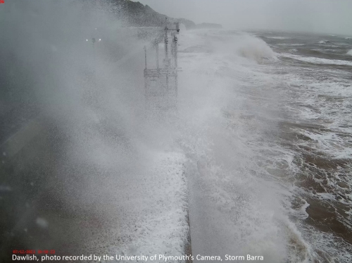
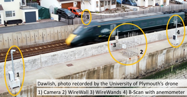
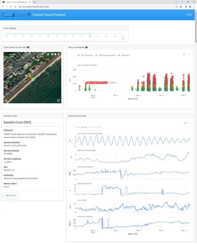
The National Oceanography Centre with the University of Plymouth have installed a new monitoring system to measure wave overtopping conditions and concurrent beach level over a 1-year period in Dawlish, SW England (Figure 1). The system obtains in-situ measurements of the inland wave overtopping distribution across a public walkway and railway line (Figure 2), and issues near real-time overtopping data to the British Oceanographic Data Centre, one of the five NERC EDS data centres, making it publicly accessible online within 15 minutes of detection. This public web service takes in near-real time wave and water level data from existing national coastal monitoring networks (Figure 3), providing a full dataset to validate and calibrate an operational wave, water-level and overtopping forecast system.
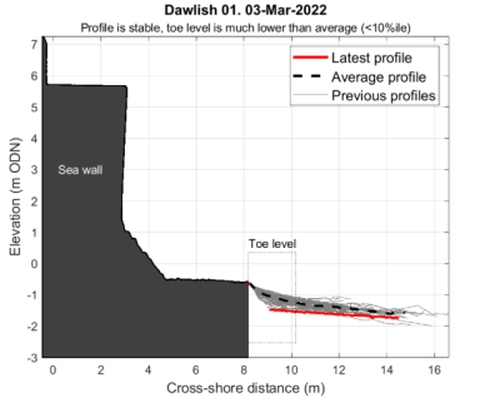
Using these data, numerical forecasts have been refined, by incorporating recent beach levels (Figure 4), to reduce the uncertainty in the wave overtopping predictions due to seasonal variability in the beach level at the toe of the sea wall at Dawlish. Working with partners at Network Rail and the South West Regional Coastal Monitoring Programme, the data will allow the re-assessment of the coastal condition combinations that most frequently pose a hazard to the railway line and the public, to support the South West Rail Resilience Programme, and identify where site-specific modifications in operational predictions can be implemented to improve local hazard forecasts.