The surveys began in 1978 and are repeated approximately every five years as a rolling survey of soil and vegetation. The first countryside survey captured detailed information from 256 1x1 km squares that each contained an average of 27 fine resolution quadrats. The latest survey will attempt to record 500 representative 1x1 km squares over a five-year period, for which the locations surveyed can be seen in Figure 1. A wide range of data have been collected in the following time periods 1978, 1984, 1990, 2000, 2007, 2019-2021. They show how soil, woodlands, common flora, and some water bodies of the UK landscape have changed over a long period of time. Below we highlight just four of the many projects that have used some of these data. Data from the Countryside Survey can be found in a collection in the EIDC catalogue.
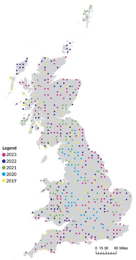
Figure 1. Map of the locations of Countryside Survey squares visited across Great Britain.
UK Soil Observatory
The UK Soil Observatory includes soil data from the UKCEH Countryside Survey. It attracts more than 100,000 visitors annually to its free-to-view maps on the web portal (see Figure 2 below).
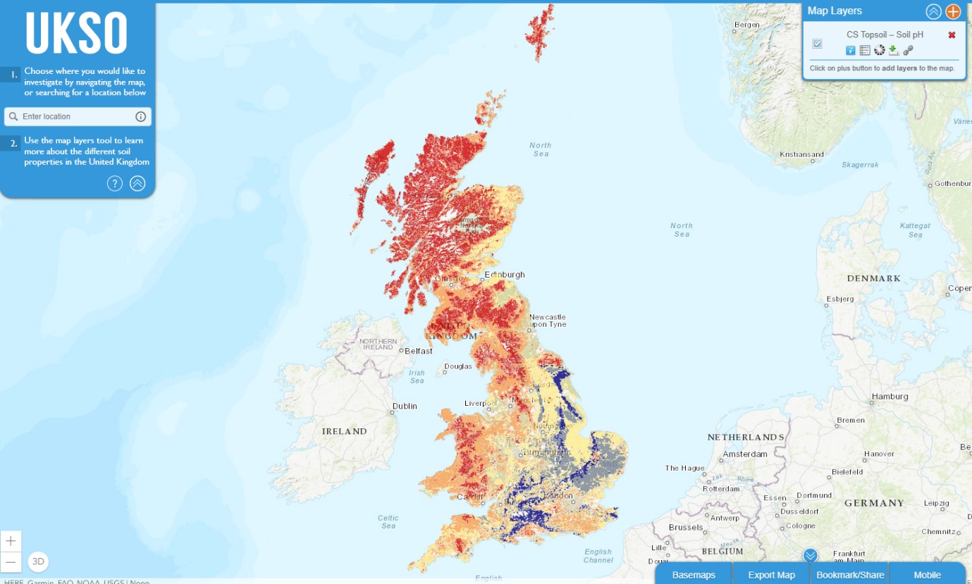
Figure 2. Screenshot of UKSO tool showing soil pH layer for the United Kingdom. Screenshot taken on 27 October 2023.
SOil funDamentals (SOD)
The UKCEH soils team has developed a web tool – UKCEH Countryside Survey Soil Health Webtool SOil funDamentals (SOD) – using Countryside Survey Soil data. It aims to help all landowners monitor and improve the health of their soil. As soils vary widely across the landscape, users need to provide a habitat, soil type and rainfall value to find out how healthy their soils are in relation to the rest of Britain.
Modular Analysis of Vegetation Information System (MAVIS)
Plant data from the Countryside Survey have been combined with other datasets to produce the popular and free MAVIS (Modular Analysis of Vegetation Information System) software. MAVIS represents many different plant communities in the same standard language, allowing for comparisons across sites and scales. It was recently reengineered by data scientists at UKCEH to improve functionality and usability and on average it is downloaded 63 times a month. It is popular with universities that are using it to help teach the next generation of ecologists and botanists.
One scientist has used MAVIS to investigate human impacts on Special Areas of Conservation (SAC):
I was able to use MAVIS to demonstrate a negative trend in both dryness and acidity at a SAC site in the Broads, and the MAVIS output thus provided the first real, incontrovertible piece of evidence that the site was suffering deleterious impacts that could be assigned to water abstraction…
Dr Jo Parmenter, Director, The Landscape Partnership, Norwich
Joint UK Land Environment Simulator
The community land surface model, Joint UK Land Environment Simulator (JULES), is one of the leading land surface models in the world. It simulates flows of energy, water, carbon and nitrogen between land, atmosphere, and soil. The fine-resolution predictions from this model are compared with data from each year of the Countryside Survey. These comparisons can be used to improve climate predictions and to identify new measurements for future enhancements.
The Countryside Survey provides a vast quantity of data that is widely used. Currently, 67 Countryside Survey datasets are held by the EIDC that are openly available and free to use. The number of datasets will continue increasing with future surveys and the addition of new locations. More types of information can be collected and repeated surveys of these locations will extend this valuable time series.
References
Joint UK Land Environment Simulator (JULES), https://catalogue.ceh.ac.uk/documents/02faa17d-fb11-4166-a069-17356032295f
UKCEH Countryside Survey, https://www.ceh.ac.uk/our-science/projects/countryside-survey
UKCEH Countryside Survey Soil Health Webtool Soil funDamentals (SOD), https://connect-apps.ceh.ac.uk/soilhealth/
Modular Analysis of Vegetation Information System, https://www.ceh.ac.uk/data/software-models/modular-analysis-vegetation-information-system-mavis
UK-SCAPE-UKCEHCountrysideSurvey-Case-Study.pdf, https://uk-scape.ceh.ac.uk/sites/default/files/2024-02/UK-SCAPE-UKCEHCountrysideSurvey-Case-Study.pdf
UK Soil Observatory, https://www.ukso.org/